Property Record
4335 Bethelview Rd, Cumming, GA 30040
NEARBY LISTINGS FOR SALE OR LEASE
Property Detail
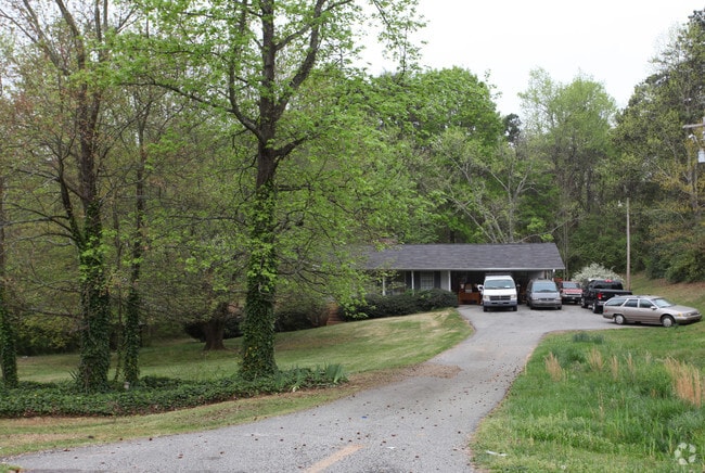
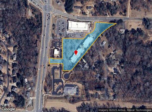
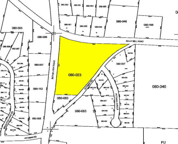
4335 Bethelview Rd
080-023
Bethelview & Hwy 09 S
Regionalshoppingcenterormallwithanchorstore
2-1 LL 51 TR 1
X
Forsyth
13117C0129F
Georgia
2024
3.70 AC
2025
N Fulton/Forsyth County
130414
Atlanta
450 SF
Atlanta-Sandy Springs-Roswell, GA
DEMOGRAPHICS near 4335 Bethelview Rd
1 Mile
3 Mile
5 Mile
2024 Total Population
6,818
44,702
99,973
2029 Population
8,042
52,129
116,452
Pop Growth 2024-2029
+ 17.95%
+ 16.61%
+ 16.48%
Average Age
38
39
39
2024 Total Households
2,194
14,513
33,481
HH Growth 2024-2029
+ 18.05%
+ 16.68%
+ 16.54%
Median Household Inc
$128,274
$129,041
$118,482
Avg Household Size
3.10
3.00
2.90
2024 Avg HH Vehicles
2.00
2.00
2.00
Median Home Value
$440,643
$450,627
$435,244
Median Year Built
2007
2006
2004
Nearby Places
Map Layers
Map Styles
 Street
 Aerial
- Restaurants
- Banks
- Shops
- Fitness
- Groceries
Nearby Properties
Address
Land Use
TOTAL SIZE
Lot Size
Zoning
Address
Land Use
TOTAL SIZE
Lot Size
Zoning
15,081 SF
27.53 AC
R3
Address
Land Use
TOTAL SIZE
Lot Size
Zoning
208,496 SF
23.61 AC
R3
Address
Land Use
TOTAL SIZE
Lot Size
Zoning
302,599 SF
35.89 AC
R3
Address
Land Use
TOTAL SIZE
Lot Size
Zoning
15,600 SF
21.98 AC
R3
Address
Land Use
TOTAL SIZE
Lot Size
Zoning
234,450 SF
95 AC
A1
Address
Land Use
TOTAL SIZE
Lot Size
Zoning
171,065 SF
16.22 AC
CBD
Address
Land Use
TOTAL SIZE
Lot Size
Zoning
207,663 SF
60.62 AC
R2R
Address
Land Use
TOTAL SIZE
Lot Size
Zoning
42.50 AC
RES3
Address
Land Use
TOTAL SIZE
Lot Size
Zoning
16.56 AC
MP
Address
Land Use
TOTAL SIZE
Lot Size
Zoning
11,737 SF
34.75 AC
A1
Address
Land Use
TOTAL SIZE
Lot Size
Zoning
152,562 SF
12.80 AC
R3
Address
Land Use
TOTAL SIZE
Lot Size
Zoning
80,598 SF
10.07 AC
CBD
Address
Land Use
TOTAL SIZE
Lot Size
Zoning
89,562 SF
10.61 AC
CBD
Address
Land Use
TOTAL SIZE
Lot Size
Zoning
235,920 SF
14.23 AC
M1
Address
Land Use
TOTAL SIZE
Lot Size
Zoning
65,612 SF
6.83 AC
CBD
Address
Land Use
TOTAL SIZE
Lot Size
Zoning
60,392 SF
1.66 AC
CBD
Address
Land Use
TOTAL SIZE
Lot Size
Zoning
89,312 SF
7.50 AC
M1
Address
Land Use
TOTAL SIZE
Lot Size
Zoning
104,724 SF
4.83 AC
M1
Address
Land Use
TOTAL SIZE
Lot Size
Zoning
101,808 SF
2 AC
CBD
Address
Land Use
TOTAL SIZE
Lot Size
Zoning
123,630 SF
20.51 AC
CBD
Address
Land Use
TOTAL SIZE
Lot Size
Zoning
121,197 SF
1.90 AC
CBD
Address
Land Use
TOTAL SIZE
Lot Size
Zoning
73,700 SF
4.97 AC
M1
Address
Land Use
TOTAL SIZE
Lot Size
Zoning
109,100 SF
10 AC
M1
Address
Land Use
TOTAL SIZE
Lot Size
Zoning
62,292 SF
32.50 AC
CBD
Address
Land Use
TOTAL SIZE
Lot Size
Zoning
33,927 SF
12.79 AC
M1
Address
Land Use
TOTAL SIZE
Lot Size
Zoning
25,281 SF
11.65 AC
RES6
Address
Land Use
TOTAL SIZE
Lot Size
Zoning
6,180 SF
0.97 AC
CBD
Address
Land Use
TOTAL SIZE
Lot Size
Zoning
34.39 AC
CBD
Address
Land Use
TOTAL SIZE
Lot Size
Zoning
78,520 SF
5.08 AC
M1
Address
Land Use
TOTAL SIZE
Lot Size
Zoning
33,774 SF
4.79 AC
R3
The World's #1 Commercial Real Estate Marketplace
Connect with us
© 2025 CoStar Group
The information above has been obtained from sources believed reliable. While we do not doubt its accuracy we have not verified it and make no guarantee, warranty or representation about it. It is your responsibility to independently confirm its accuracy and completeness. Any projections, opinions, assumptions, or estimates used are for example only and do not represent the current or future performance of the property. The value of this transaction to you depends on tax and other factors which should be evaluated by your tax, financial, and legal advisors. You and your advisors should conduct a careful, independent investigation of the property to determine to your satisfaction the suitability of the property for your needs.